Culture, Language, Script and Alphabet
The Georgian language is the state language of Georgia. The most ancient Georgian inscriptions are Mrglovani or Asomtavruli dates back to the 5th century A.D., Nuskhuri dates back to the 9th century A.D., Mkhedruli inscriptions used today belongs to the 10th century. Georgian is the only language in the Ibero-Caucasian family having ancient script. According to the Georgian tradition the Georgian alphabet was created in the 3rd century B.C. by Georgian king Pharnaoz and is among the 14 existing ones all over the world. It includes 33 symbols (28 consonants and 5 vowels). The shape of the letters is unique, with round forms and it can not be compared to any other alphabet. The main important thing which makes difference from other old languages is that Georgian original and translated works written 15 centuries ago are understandable for educated readers, but works in old Greek and Latin languages need translation for modern Greeks and Italians.
Georgian literature dates back to the fifth century A.D. The earliest surviving Georgian text has existed from the 5th century Martyrdom of Shushanik by Iakob Tsurtaveli. The most important work was Georgia’s national epic poem, “The Knight in the Tiger’s skin” by Shota Rustaveli. Scholars have compared the 12th century Georgian poet Shota Rustaveli to Dante and Shakespeare. From the written inscribes, the oldest is inscribe of Bethlem Monastery in Palestine (432-433), but on Georgian territory, inscribe of Bolnisi Sioni (493-494).
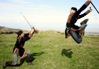
Music, Georgian National dancing, canticles and folksongs in particular, form one of the most important elements of Georgian culture. Georgian songs are famous by their complicated polyphony and are still very significant for Georgians and have been preserved in almost all parts of Georgia. There are various genres of songs: supruli (songs for the table, Mravalzhamier), satrpialo (love songs), sagmiro (epic songs) and sagalobeli (church songs). Since the 19th century Georgia has also developed a classical music tradition. The great Georgian composer was Zakaria paliashvili, his famous works are “Abesalom and Eteri” (1919) and “Daisi” (1923). Tbilisi Opera House is named after him. Many internationally famous Georgian musicians Liana Isakadze, the bass Paata Burchuladze, the Georgian National Quartet, The pianists Lexo Toradze and Eliso Virsaladze perform mostly abroad. Traditional Georgian dances are known world-wide. At the wedding ceremonies it’s important that just married couple has to dance Georgian dance in spite of they know or don’t know it. Each region has its own dances: Achara and Guria have the Khorumi, a soldiers dance; Khevsureti has the Khevsuruli, a dance in which men fight over a woman with swords etc. Georgian national ensembles have reached the most success all over the world (ensembles: Sukhishvili National Ballet, Erisioni, Rustavi). Georgia also has great performers of classical ballet Vakhtang Chabukiani in the 1930s and the present Nino Ananiashvili and Irma Nioradze.
The sense of national identity of the Georgian people was always closely related to the rich cultural heritage of their country. The need for the care of their cultural heritage is deeply rooted in the consciousness of the Georgian people. A rare inscription of the 12th century preserved in St Savior’s church in Svaneti, the region, where people and towers stand with the same obstinacy, says – “Who will be abbot of this church, should defend these painting from smoke to avoid defacing and damaging their colors” can be regarded as a symbol of the attitude of Georgians towards their cultural heritage. This appeal for the preservation and maintenance of their cultural heritage by the priest, Kvirike, serves as a motto from generation to generation.
Food & Wine
 About Wine
Georgia is “a cradle of wine”, there is a theory that the word wine “vino”, “vin”, “vein”, “vine”- has Georgian roots and comes from Georgian ”gvino” ( wine ) , vine shoots, grape stones, wine vessel (pitchers, bowls, vine processing instruments- 7000 B.C ), Aguna the patron deity of vine and wine (XI-X centuries), Badagon (VII-V B.C.) and the ancient astrological calendar confirm the oldest history of wine and vine in Georgia. “Nowhere people drink so much and so majestic wine as in Georgia”- Sharden French traveler-XVII century. There is no bad wine in Georgia; it’s good or better. It’s especially wonderful the wine, which is made by “glekhuri” (peasant) way. Such wines beloved by Strabbo, Herodotus and Plutarch cure intestinal, radiation, potential activity and other diseases. “Nowhere in the whole world, local wines doesn’t so combine with local meal as in Georgia”-”Decanter” English magazine.
The history and life style in Georgia have always been so closely connected with viticulture that now you can only guess vine or man appeared in Georgia first, probably both at the same time and they still support each other -wine as a symbol of Georgian hospitality, tolerance and a key to the mystery of Georgian longevity.
There are over 500 different types of grape, the most famous being Rkatsiteli, Mtsvane and Saperavi. The traditions of wine-growing and wine-making have remained intact passing from fathers to sons, from generation to generation.
 Food
Food
Georgians eat any time of day, and often the food dished up for breakfast may be similar to what you eat at dinner, including the wine if you are the guest of the Georgian family. The ingredients are usually fresh, many dishes include walnuts, garlic and spice.
The favorite Georgian dishes are Khachapuri or cheese pie, Khinkali (meat in boiled paste), Mtsvadi (roast meat), Satsivi or Walnut Sauce with turkey or chicken, Elarji (maize porridge with Georgian cheese Sulguni). Other tasty sauces include the wild plum Tkemali and the hot chili Ajika. For a breakfast with a difference, try the “khashi”, a soup of tripe, cow hoof and lots of garlic. There are a lot of variations of these dishes and each region in Georgia has its own recipe. Georgians, also prepare very good bread and delicious sweets like Churchkela (nuts in boiled grape juice), Pelamushi (boiled grape juice), which tastes are unforgettable.
Geography of Georgia
Geographic location:
Southwestern Asia (Caucasus)
Longitude: 40 o – 47 o E
Latitude: 41 o – 44 o N
Land bordaries: 1970 km (1224 miles)
Land border: 1655 km (1028 miles)
Georgian section of the Black Sea coast line: 315 km (195 miles)
Armenia: 164 km
Azerbaijan: 322 km
Russia: 723 km
Turkey: 252 km
Area: 69.700 km 2 (26,911 sq miles)
water: 0 sq km
land: 69,700 sq km
Land use:
arable land: 11.21%
permanent crops: 4.09%
other: 84.71% (1998 est.)
Irrigated land: 4,700 sq km (1998 est.)
Elevation extremes:
Highest: Mt. Shkhara-5068.m
Lowest: Black Sea 0 m
Georgia is a mountainous country. The Northern geographical boundaries run along the Great Caucasian Range, which includes the Main Caucasian Range, and its other chains stretch to the South. The Southern boundary coincides with the mountainous system of the Minor Caucasus, including the Meskheti – Trialeti volcanic plateau. Between the Great and Minor Caucasus plains are located. The Western part of the country is washed by the Black Sea.
Highest mountains:
Shkhara – 5068 m (16,627 ft)
Janga – 5059 m (16,597 ft)
Mkinvartsveri (Kazbek) – 5047 m (16,558 ft)
Shota Rustaveli – 4860 m (15,944 ft)
Tetnuldi – 4858 m (15,938 ft)
Ushba – 4700 m (15,419 ft)
Ailama – 4547 m (14,917 ft)
Longest rivers:
Mtkvari (Kura in Russian) – 1364 km (847.5 miles)
Chorokhi – 438 km (272.1 miles)
Alazani – 351 km (218.1 miles)
Rioni – 327 km (203.1 miles)
Tori – 320 km (198.8 miles)
Enguri – 213 km (132.3 miles)
Largest lakes:
Paravani – 37.5 sq.km (14.4 sq ml)
Kartsakhi – 26.3 sq.km (10.1 sq ml)
Paliastomi – 18.2 sq.km (7.0 sq ml)
Tabatskuri – 14.2 sq.km (5.4 sq ml)
Khanchali -13.3 sq.km (5.1 sq ml)
Jandari – 10.6 sq.km (4.0 sq ml)
Georgia is located in wrinkled Alpine zone, in Subtropical zones of northern periphery.
The geological constitution is characterized by the precipitation is basically of Mesozoic and Cainozoic era. According to the wrinkles it’s divided by several Geotectonical units: from North to the South by Caucasian main ring’s Antiklinorium, main Caucasian range, wrinkles system, Georgian Belt, Achara-Trialeti system, Artvin-Bolnisi Belt and Loc-Karabag’s wrinkled zone.
Georgia differs by it’s contrast relief. It is represented by high, middle and low mountain highland plane unity. The Caucasus are reflected sharply, inter mountain lowland.
The territory of the Georgia features a highly contrasting topography. The north of the country is occupied by the Greater Caucasus chain (highest point – Mt. Shkhara, 5068 m), which includes the Great Caucasian Range (the main watershed) and Gagra, Bzipi, Kodori, Svaneti, Egrisi, Racha, Lomisi, Kartli and other ranges. The inter mountain depression to the south of the Greater Caucasus encompasses the Kolkheti lowland, Inner Kartli, Lower Kartli and the Alazani Plain. Still further to the south the Minor Caucasian ranges rise to the medium height (Meskheti, Shavsheti and other ranges), reaching 2850 m. The southernmost area of the country is covered by the volcanic South Georgian Upland (Mt. Didi Abuli, 3301 m, its highest peak), dissected by specific canyon-like river gorges.
The Greater Caucasus and the South Georgian Upland join with the Likhi Range, which at the same time divides Georgia into two contrasting climatic zones: Western and Eastern Georgia.
The rivers of Georgia belong to the basins of the Black and Caspian Basin flows the Mtkvari river with its numerous tributaries (left) the Didi Liakhvi, the Aragvi, the Iori, the Alazani, (right) the Paravani, the Algeti, and Khrami. The Black Sea Basin rivers include the Rioni, the Enguri, the Acharistskali, the Bzipi and others. There are not many lakes in Georgia, the largest being Lake Paravani (37 sq. km), and Lake Paliastomi (17,3 sq. km), and the deepest Lake Ritsa (116 m) and Lake Amtkeli (72-122 m) (both are impounded lakes).
The glaciers are only on Caucuses (688) and occupy 508 sq. km (country area’s 0.7%). Regular snow line hesitates on 2800-3600 meter
Georgia is rich with underground waters, there are mineral and thermal waters (Borjomi, Utsera, Dzau, Nabeglavi, Sairme, Zvare, Nunisi etc.).
Soils: Spatial distribution of soils in Georgia is characterized by vertical variability.
On the Georgian territory there are almost all types of soil:
Red soil of the humid subtopic zone of the west Georgia.
Black soil of the east Georgian valleys and desert-valleys
Brown soils of the east Georgian transient forest-valley
Mountain-forest soils
Mountain black soils
Mountain-meadow soils
Alluvial soils
Moor soils
Salted soils
Kolkheti lowland is dominated by swamp soils with an area totaling to 200 600 ha (3.0% of the countries territory).
In Atchara and Guria foothills at an elevation of 300-400 m from the sea level red earth with an area of 130 400 ha. (1.9%). is the predominant type of soil.
In Imereti and Apkhazeti yellow earth soils are spread at 300-400 m (above the sea level), 225 800 ha (3.2%). In the southern part of Samegrelo the old sea terraces are dominated by subtropical soils, 317 600 ha (4.5%).
In western Georgia, at an elevation of 400-1000m non calcareous parent rocks are covered by yellow and brown forest soils, 106 000 ha (1.5%).
In Western and Eastern Georgia soil variability is observed only under 1000m. At high elevations soil types are homogeneous. At the same time, the southern parts of the country is characterized by vertical variability.In Western and Eastern Georgia at an elevation of 1000-2000m (above the sea level) soils are of brown forest type, 1 172 200 ha (16.9%).
On the whole territory of the country 1800-2000m (above the sea level) elevations are covered by mountain-forest-meadow soils, 492 000 ha (7.2%); 2000-3700m (above the sea level) — mountain-meadow soils, 1 477 200 ha (22.1%). Calcareous parent rocks above the 700m (above the sea level) humus carbonate soils are dominant, 317 200 ha (4.5%).
In the East of the country (Gardabani and Marneuli districts), 350-500m (above the sea level), grey-cinnamon and meadow-grey-cinnamon soils cover the surface, 511 400 ha (7.3%).
The south-eastern parts of the country is dominated by black soils, 266 800 ha (3.7%).
In the Eastern Georgia and mainly on Alazani lowland dominate salt soils, 112 600 ha (1.6%).
Middle belts of the Southern Georgia mountains are covered by black earth soils, 157 600 (2.2%)
Regions of Georgia
Tbilisi, Mtskheta-Mtianeti, Kakheti, Samegrelo, Kartli, Dmanisi, Samtskhe-Javakheti, Racha-Lechkhumi, Imereti, Guria, Adjara, Khevi, Svaneti, Tusheti, Khevsureti, Dmanisi
Tbilisi
Legend has it that the present-day territory of Tbilisi was covered by forest as late as the AD 458. According to one account King Vakhtang I Gorgasali of Georgia went hunting in the heavily wooded region with a falcon (sometimes the falcon is substituted either by a hawk or another small birds of prey in the legend).
The King’s falcon caught/injured a pheasant during the hunt, after which both birds fell into a nearby hot spring and died. King Vakhtang became so impressed with the discovery that he decided to build a city on this location. The name Tbilisi derives from the Old Georgian word “Tpili”, meaning warm. The name Tbili or Tbilisi (“warm location”) therefore was given to the city because of the area’s numerous sulfuric hot springs.
Archaeological studies of the region have revealed that the territory of Tbilisi was settled by humans as early as the 4th millennium BC. The earliest actual (recorded) accounts of settlement of the location come from the second half of the 4th century AD, when a fortress was built during King Varaz-Bakur’s reign. Towards the end of the 4th century the fortress fell into the hands of the Persians after which the location fell back into the hands of the Kings of Kartli (Georgia) by the middle of the 5th century. King Vakhtang I Gorgasali (reigned in the middle and latter halves of the 5th century), who is largely credited for founding Tbilisi, was actually responsible for reviving and building up the city but not for founding it. The present-day location of the area, which Gorgasali seems to have built, includes the surroundings of Metekhi Square (Abanot-Ubani historical district).
When talking about Georgia, lovely imagination of Tbilisi – a city of dreams, love and sunshine, comes in the mind’s eye.
The capital of Georgia has not become so beautiful at once. Its 15-century-old history remembers war times, legendary heroism and patriotism of the Georgian people. Like phoenix Tbilisi repeatedly revived from ashes and thanks to its culture and powerful economy over and over it ranked with the world’s biggest cities. Ancient legend concerning the foundation of the city has passed on from one generation to another. While hunting king Vakhtang Gorgasali shot down a pheasant. The bird was chased by the King’s falcon and they both fell into a hot spring. The King saw the birds were boiled. He liked the place and ordered a city to be built there. The name of the city is originated from the warm springs of sulphur water. Georgian “tbili” is “warm”.
The Tbilisi sulphur springs are mentioned in the works of many historians, writers and travelers of the world. The French writer Alexander Dumas even regretted that these springs weren’t in Paris. There is a page dedicated to the unique healing sulphur springs in the Glory Book of Tbilisi. The temperature of some of the springs often reaches 47˚C. Tbilisi is situated in the East Georgia in the latitude of 41˚43’ North and longitude of 44˚48’ East.
It is at the distance of 350 km. from the Black Sea and 550 km. from the Caspian Sea. The city is situated at different altitudes – it is 397 m. at the Metekhi Citadel, 488 m. at the foot of Mtatsminda mountain, but the mountain itself is 727 meters a.s.l. What kind of a city was Old Tbilisi? In 1876 the population of the city reached 104 thousand and the territory – 804 hectares from which different erections occupied 55 percent, park – 17, squares and cemeteries each – 4. There were only 14665 constructions, 205 streets, 101 by streets and 16 squares.
After Georgia was annexed by Russia (1801) Tbilisi became administrative center of the Tran Caucasus. From now on the city begins to acquire an European look. Being of peculiar color the city always attracted people from different parts of the world. It was a dream of world’s outstanding poets, scientists and travelers to visit Tbilisi.
Thoughts of famous figures about Tbilisi.
Well-known traveler Marco Polo called Tbilisi a beautiful city, the Pope Joan XXII marked that Tbilisi was not only the centre of Georgian kingdom, but it also was one of the most beautiful cities of the world. Being fascinated by Tbilisi, the French novelist Alexander Dumas with great admiration gives his impressions and praises the capital of Georgia in the book “Le Caucase”.
Travelers often compared the capital of Georgia with Paris. Emile Levier, the French botanist, wrote: “The city is charming from the top of Mtatsminda. It seems to me as if I were looking at illuminated Paris from the Eiffel Tower”. Rumors about beautiful Tbilisi reached the great French novelist Honoré Balzac who afterwards wrote to his friends: “We want to go to the Crimea and the Caucasus and visit Tbilisi”. Russian writers and travelers give interesting reminiscences about Tbilisi. Evgeni Markov: “Tbilisi belongs to the number of ancient cities not only in the Russian empire but also in Europe.
Antiquities of Kiev and Novgorod belong to some hundred years’ later period than those of Tbilisi. Basil Sidorov: “The streets are bubbling with life and I felt the pulse of a big city. Yes, it was Tbilisi, one of the most original cities of our planet”.
Jacob Polanski: I’m fond of walking here,
Tacitly watch and admire
The scenery and songs so sweet to hear,
Never to forget those happy years”.
The second part of the 19th century is marked by a rapid growth of industry in Tbilisi and the formation of local proletariat that played a great role in the revolutionary movement of Georgia. In the first years after the establishment of Soviet power in Georgia (1921), the population of the capital hardly reached 230 thousand. 40 years later it made the number of 800 thousand and already in 1974 Tbilisi is ranking with the cities with a million population.
At present it occupies the territory exceeding 36 thousand hectares that is 40 times as much as in 1876. The climate in Tbilisi is continental. Average temperature total to +12.6 C. Sharp fluctuation of the temperature is caused by the main Caucasian ridge that is hundreds of kilometers far from Tbilisi. The summer is long, dry and hot in Tbilisi.
Modern Tbilisi is a city of powerful industry, the centre of the Tran Caucasian economic region. There are over a thousand factories and plants of machine – tool building, metal and woodworking, electric apparatus, canning, food and light industries. Trams, buses, mini-buses, taxis, the underground, the funicular railroad and rope-ways serve the citizens. Tbilisi is a great railway, motor transport and air line junction.
Mtskheta – Mtianeti
MTSKHETA – The Ancient Capital Situated at the confluence of the Aragvi and Mtkvari rivers, Mtskheta has been a site of human settlement since at least the second millennium BC. The town is named after Mtskhetos, son of Kartlos – the legendary progenitor of the Georgian people. Already a town of some significance in pagan times, it gained importance as the site of the first Christian church in Georgia. Today it is no longer the capital of the country, but it is still the spiritual capital and home to two of Georgia’s greatest churches – Svetitskhoveli and Jvari.
Highlights
Jvari Monastery is located at the top of the hill and is the place where the missionary St Nino herself erected a cross (“jvari” in Georgian) in the 4th century to mark the coming of Christianity to Georgia. Two centuries later, this monastery was built on the same spot.
Svetitskhoveli is the royal cathedral of Georgia, used for centuries for the coronation and burial of Georgian monarchs. More importantly, it is considered one of the holiest places in Georgia since the Robe of Christ is believed to be buried here, having been brought to Georgia in the 1st century by a Jew from Mtskheta named Elias. The story tells that on his return to Mtskheta, his sister Sidonia came out to meet him and, on seeing the sacred robe, was so overcome with emotion that she clutched it to her breast and died in a state of religious ecstasy. As it was impossible to pry the robe from her grasp, it was buried with her near the confluence of the two rivers where the 11th century cathedral is now located.
Shio-mgvime Monastery (“Cave of Shio”) was founded by one of the 6th century Syrian Fathers who lived here as a religious recluse in a dark cave for 20 years, praying and devoting himself to God.
Samtavro Monastery – A little 4th century church marks the site where St. Nino lived and prayed, while a larger 11th century building holds the tombs of her contemporaries – Georgia’s first Christian monarchs, King Mirian and Queen Nana.
Kakheti
Kakheti is a province in Eastern Georgia. It is bordered by the small mountainous province of Tusheti and mountain-range of Greater Caucasus to the north, Azerbaijan to the east and the south, and the Georgian province of Kartli to the west. Kakheti is geographically divided into the Inner Kakheti to the east of Tsiv-Gombori mountain-range and the Outer Kakheti to the west of it. The major river of the eastern part is Alazani, of the western part – Iori. Kakhetians speak a local dialect of Georgian.
The Georgian David Gareja monastery complex is partially located in this province and is subject to a border dispute between Georgian and Azerbaijani authorities.
Beyond the modern-day administrative subdivision into the districts, Kakheti has traditionally being subdivided into four parts: Inner Kakheti along the right bank of the Alazani River, Outer Kakheti along the middle Iori River basin, Qiziki between the Alazani and the Iori, and Thither Area on the left bank of the Alazani. It also includes the medieval region of Hereti whose name fell into gradual oblivion since the 15th century.
The Alazani River Plain, with the Caucasus Mountains in the backgroundKakheti was an independent feudal principality from the end of the eighth century. It was incorporated into the united Georgian Kingdom at the beginning of the eleventh century, but for less than a decade. Only in the beginning of the twelfth century did Georgian King David the Builder (1089–1125) incorporate Kakheti to his Kingdom successfully. After the disintegration of the Georgian Kingdom, Kakheti became an independent Kingdom in the 1460s. In 1762, the Kakhetian Kingdom was united with the neighboring Georgian Kingdom of Kartli, with the capital of the former, Telavi, becoming the capital of the united Eastern-Georgian Kingdom of Kartl-Kakheti. Both Kingdoms were weakened by frequent Persian invasions. In 1801 the Kingdom of Kartl-Kakheti was annexed to the Tsarist Russian Empire.
In 1918–1921 Kakheti was part of independent Democratic Republic of Georgia, in 1922–1936 part of Transcaucasian SFSR and in 1936–1991 part of Georgian SSR. Since the Georgian independence in 1991, Kakheti is a region in the Republic of Georgia and Telavi is still its capital.
Samegrelo
This region; situated between the Rioni, Tskenitskali and Enguri rivers. Samegrelo has its own very strong identity, symbolized by the use, alongside Georgian, of the Megruli (Megrelian) language. Samegrelo is however, famous for its cuisine, which tends to be spicier than elsewhere in Georgia, look out especially for Sulguni cheese and Ghomi maize porridge with Satsivi chicken. Poti Poti, Georgia’s main port. It was originally the Greek trading colony of Phasisi. Its history reflects the myth of Jason and the Argonauts. Maltakva. This resort is 3km to the South of Poti. In this direction there are more restaurants and other amenities, possibly due to proximity of the Supsa oil terminal and its foreign workers.
At Maltakva there is the Okros Tba (Golden Lake) water sports complex used in 1991 for the European water sports championships. Lake Paliastomi Of the many rivers and lakes here Lake Paliastomi is the most beautiful. It has an area of 18.2 sq. km. but its maximum depth is only 3m. The lake has an island, Bokveradzis Kundzuli, which is an excellent place for bird-watching. Zugdidi The Administrative center of samegrelo Zugdidi is 318km from Tbilisi, 104 km from Kutaisi. The first known reference to it dates from as late as the 17th century, when it became the residence of the local dukes, the Dadiani family.
For around 300 years the Turks hurried the Zugdidi area until in 1803 Grigol Dadiani agreed that Samegrelo should be an Russian protectorate. Afterwards the Dukes Levan and David paid a lot of attention to improving Zugdidi, laying out roads and a botanical garden among other projects. In 1855 The Turks captured Zugdidi and burnt the palace , but it was soon recaptured. Museum of History & Ethnography. This is located in the former palace of the Dadianis , in the square behind the football stadium in David Agmashenebelis Gamziri.
The original palace was built in the 17th century but what you see now mainly dates from 200 years later. It is an attractive mixture of neo-Gothic and Venetian, and was specially decorated as a kind of Wedding present by David Dadiani to his wife, Ekaterina Chavchavadze. After her husband ‘s death Ekatherina had to confront an uprising by Megrelian peasants , who occupied the palace, demanding changes in the law to ameliorate their serfdom. Her inability to understand their complaints led concerned Russian Imperial government to abolish the autonomous powers of the Dadiani family and to St. Petersburg in 1857. Her daughter Salome married Prince Achille Napoleon Murat , the grandson of Napoleon’s sister and Marshal Murat. The Palace contains of the three bronze copies of the death mask of Napoleon.
The museum collection includes Colchian artifacts, such as a very interesting 1st century golden head of a deer, many coins, fine pieces of glass and embroidery from the 11th to 13th centuries, icons from Megrelian Monasteries, including one which belonged to Queen Tamar’s mother, and examples of typical Megrelian Houses. There are also some religious relics, mostly from Khobi monastery, which are usually kept, locked up in the storerooms. Botanical Gardens These gardens were planned by David and Ekaterina Dadian. The plant are from Europe, Asia and North America. They used to be well maintained , but in recent times the gardens have suffered too. But they ‘re still Pleasant enough, and free.
Kartli
Kartli is the largest and most populated province of Eastern Georgia. It includes the Georgian capital, Tbilisi, and two other major cities, Gori and Rustavi. It is bordered by the mountain-range of the Greater Caucasus to the north, by the province of Kakheti to the east, by Azerbaijan and Armenia to the south, by Turkey and the Samtskhe-Javakheti region to the south-west and by the province of Imereti to the west.
In the 3rd century BC the ancient Eastern Georgian Kingdom of Kartli, also known as Iberia, was established here. Its king declared Christianity as the official religion of Kartli in 337 AD. In the early Middle Ages, Kartli lost its political importance because of the struggle between the King and strong feudal rulers, as well as the aggression of the strong Persian Kingdom. Even so, in a way, it remained Georgia’s leader because of the independence of its Church and culture from Byzantine influence. Kartli was part of the united Georgian Kingdom in the central Middle Ages. (Georgia was united at the beginning of the 11th century, but Tbilisi, Kartli’s main city, was not liberated until 1122. Immediately afterwards, the Georgian capital moved from Kutaisi to Tbilisi.) After the disintegration of the united Kingdom in the 15th century, Kartli became an independent Kingdom, which suffered from frequent Persian invasions. In 1762, the Kingdom of Kartli was united with the neighboring Kingdom of Kakheti. This Kingdom too was soon weakened by the Persian aggression. In 1801 the Kingdom of Kartl-Kakheti was annexed to the Russian Empire.
Dmanisi
Finding of the first European in Dmanisi gives evidence that Georgia was located on a crossroads of migration routes and a man from Africa got to Europe exactly via Georgia. After this discovery it is without any doubt that Georgia is a motherland of the first European.
Short discription of Dmanisi District:
Location – 100 kilometers from the city in the south-west part. Area – 1190 km2. Population – 29868. Religion – Orthodox 36,7%, Muslim – 62,7%, other – 0. 6%. Time zone: GMT 3.00h. Tel code – 8 260, electrical force – 220 volts. Bordering country and districts: Armenia, Tetritskaro District, Tsalka District and Ninotsmonda District. Climate – temperate. The highest mountain – Trealeti. Number of villages – 57, rivers – Khrami, Mashavera, Pinezauri, lakes – Pantiani, Iakulbo and Gomareti five lakes. reservoirs. Minerals – basalt, granite, tuff, lime stone, clay, peat, gold, silver and etc.
Motherland of the first Europeans
Nowadays Dmanisi attracts attention from the whole world. A great number of diplomats, scientists, students, tourists from different countries come here to see it. Why is it so interesting? Dmanisi as well whole Kvemo Kartli region is rich with its history. Many archeological and architectural monuments, dated back to Bronze Era, Antique Era and Middle Ages, are discovered in this district. The most important is Dmanisi Ancient Settlement, where after archeological investigation the whole history of our country and all periods of pre-history were discovered. The layers of Late-Bronze, Early-Iron, Antique eras and Middle centuries were determined and a lot of archeological materials were found. On the promontory formed by the confluence of the Mashavera and Phinezauri Rivers was situated one of the most powerful town. It was crossed by the main trade roads from East, Asia and West Europe.
Dmanisi Ancient Settlement is very unique. In the center of the settlement deep in the layers under the buildings dated back to centuries a great number of (presently extinguished) animals (rhinoceros, elephant, giraffe, gigantic ostrich, tiger and etc.) and Human bones (5 craniums, 4 mandibles and about 60 other parts) were discovered. According to the sciences’ definition Dmanisi Homo Erectus belong to Homo Erasers and are 1,7-1,8 year-old. The first homos outside Africa was discovered in Dmanisi. And it is already formulated the idea that Dmanisi is the motherland of the first Europeans.
The maze of Birtvisi Canyon is located about 60 km, South-West of Tbilisi, on the left bank of the river Algeti. An amazing natural shelter was discovered by local Lord back in 8th or 9th century, where he ordered to build an isolated hidden city which later became one of the most protected fortress-cities in Eastern Georgian Kingdom. But in 1403, on his eights attempt, it was conquered by Tamerlane.
On this enjoyable trek, you will feel the incredibility of nature, where in the labyrinth of the canyons and miraculous forest lay the great secrets of an ancient civilization.
David Lordkipanidze, who won a Rolex Award in 2004 for his plans to expand exploration of the earliest known settlement outside Africa, has made more discoveries at the archaeological site underneath the medieval village of Dmanisi, in southeast Georgia.
The latest discoveries – the 1.77-million-year-old skeletons of three adults and a teenager – have legs and feet adapted for long-distance walking and running, similar to those of modern humans, but have hands and arms similar to those of our tree-dwelling ancestors. The ancient Dmanisi inhabitants, who have some human features and some ape-like features, share characteristics with both Homo erectus, originally thought to be the first Homo species to migrate from Africa to Europe, and Homo habilis, the oldest species with human attributes found in Africa.
Dr Lordkipanidze and his team of researchers reckon that the Dmanisi individuals were 1.45- to 1.66-metre-tall meat-eaters who probably slept in trees at night for safety.
The latest findings, which also raise questions about the evolution of Homo sapiens and about migration out of Africa, were revealed in a major article in Nature magazine in September 2007, written by Lordkipanidze and his team of European and American researchers.
“Dmanisi is not only the oldest site outside Africa, but also the most prolific – a treasure trove of prehistoric archaeology”, says Lordkipanidze, who is director of the Georgian National Museum in Tbilisi.
Only 5 per cent of the 13,000-square-metre site at Dmanisi has been excavated and, for much of the time since the archaeological work began in earnest in 1991, it was protected only by a plastic tarpaulin roof. Now, partly with the funding from his Rolex Award, Lordkipanidze and his colleagues have had a dome built over the site to protect it from the weather and from looting.
Samtskhe-Javakheti
Samtskhe-Javakheti is a region in southern Georgia, with Akhaltsikhe as its capital. Samtskhe-Javakheti comprises six administrative districts: Akhaltsikhe, Adigeni, Aspindza, Borjomi, Akhalkalaki and Ninotsminda. There are 5 municipal, 6 settlement (small town), 67 community and village Sakrebulos, and totally 268 villages in the region.
It is bordered by Guria and Imereti to the north, Kartli (Shida Kartli and Kvemo Kartli) to the north-east and to the east, Armenia and Turkey to the south, Ajara to the west. Baku-Tbilisi-Ceyhan oil pipeline and South Caucasus natural gas pipeline passes through this region.
Racha
Racha is a historic province in Georgia, in the mountainous northwestern part of the country. Comprising the present-day districts of Oni and Ambrolauri, it is included in the region of Racha-Lechkhumi and Kvemo Svaneti. It is bordered by the mountain-range of Greater Caucasus to the north and east, Imereti to the south, Lechkhumi and Svaneti to the west. It is situated in the northern valley of Rioni river and is surrounded by mountains. Formerly, Racha included also a northwestern corner of the present day breakaway region of South Ossetia.
An old fortress in Racha in the 19th century.Racha had been part of Colchis and Caucasian Iberia since ancient times and its main town Oni was said to have been founded by King Pharnajom of Iberia in the 2nd century BC. Upon creation of the unified Georgian kingdom in the 11th century, Racha became one of the duchies (saeristavo) within it. Rati of the Baghvashi family was the first duke (eristavi) appointed by King Bagrat III. Descendants of Rati and his son Kakhaber, eponymous father of Racha’s ruling dynasty of Kakhaberisdze, governed the province until 1278. In 1278 King David VI Narin abolished the duchy during his war against the Mongols. In the mid-14th century, the duchy was restored under the rule of the Tcharelidze family.
The next dynasty of Chkhetidze governed Racha from 1465 to 1769. Vassals of the King of Imereti, they revolted several times against the royal power. The 1678-1679 civil war resulted in the most serious consequences. In this war, Duke Shoshita II of Racha (1661-1684) supported Prince Archil, a rival of the pro-Ottoman Imeretian king Bagrat IV. On the defeat of Archil, Racha was overrun and plundered by an Ottoman punitive force. Under Rostom (1749-1769), the duchy became virtually independent from Imereti. However, towards the end of 1769, King Solomon I of Imereti managed to arrest Rostom and to abolish the duchy. In 1784, King David of Imereti revived the duchy and gave it to his nephew Anton. Local opposition attempted to use an Ottoman force to take control of Racha, but the victory of King David at Skhvava (January 26, 1786) temporarily secured his dominance in the area. In 1789, the next Imeretian king Solomon II finally abolished the duchy and subordinated the province directly to the royal adminis.
Imereti
The Kingdom of Imereti was established in 1455 by a member of the house of Bagration when the Kingdom of Georgia was dissolved into rival kingdoms. Before that time, Imereti was considered a separate kingdom within the Kingdom of Georgia, to which a cadet branch of the Bagration royal family held the crown beginning in 1260 by Davit VI, King of Georgia.
This was due to the Mongolian conquest of the 13th century which decentralized and fragmented Georgia, forcing the relocation of governmental centers to the provinces. From 1455 onward, however, the kingdom became a constant battleground between Georgian, Russian, Persian, and Turkish forces until it was annexed into Russia completely in 1810. Throughout the course of that time, Mengrelia, Abkhazia and Guria princedoms declared their independence from Imereti and became their own governments.
Guria
Geography
Guria is bordered by Samegrelo to the north-west, Imereti to the north, Samtskhe-Javakheti to the east, Ajaria to the south, and the Black Sea to the west. The province has an area of 2,003 km².
Guria consists of three administrative districts:
* Ozurgeti
* Lanchkhuti
* Chokhatauri
History
The toponym “Guria” is first attested in the c. 800 Georgian chronicle of Pseudo-Juansher. The province had been under the rule of western Georgian rulers until the creation of the unified Georgian “Kingdom of Abkhazians and Georgians” towards the end of the tenth century AD. Guria then was a province (saeristavo) governed by an eristavi (duke). Following the disintegration of the Kingdom of Georgia in 1466, Guria turned into an independent principality (samtavro) under the noble family of Gurieli, nominal vassals of Imeretian kings. Attacked by the Ottomans at the turn of the sixteenth century, Guria lost Adjaria and became a tributary of the Sultan. In permanent disputes with neighbouring Georgian rulers, two princes of the Gurieli family Giorgi III Gurieli (reigned 1664-1684) and Mamia III Gurieli (reigned 1689-1714) were too successful to become king of Imereti in the late seventeenth century. Throughout the eighteenth century, Gurian princes were involved in anti-Ottoman liberation wars of the western Georgians. As a result, Guria lost the whole Adjaria and Lower Guria, part of which was forcibly Islamized. Prince Mamia V Gurieli accepted Russian sovereignty on 19 June 1810. Russian domination resulted in the 1819-1820 uprising. In 1828, the Tsarist government abolished the principality and annexed it to Kutais Gubernia in 1840. The 1841 peasant unrest as well as the 1905 uprising against the Russian rule was brutally suppressed. The former principality of Guria formed Ozurgeti mazra within the independent Democratic Republic of Georgia (DRG) in 1918-1921 and was divided into three districts under the Soviet rule. The region (mkhare) of Guria was created in 1995.
The Orthodox churches of Likhauri and Shemokmedi are the main historical buildings in the province.
Origin of the name “Guria”
As for the etymology of the name of Guria, some say that the root of the word refers to restlessness and the word should mean “the land of the restless” and may be associated with events during the eighth and ninth centuries when “Leon became the King of Abkhazeti, Guruls refused to obey the ruler of Odzrakho, ceased their vassal relations with Adarnase and Ashot Bagrationi and united with Leon” as it was described in Vakhushti Bagrationi’s historical works of the eighteenth century.
According to the later explanation, in the times of Georgia’s prosperity, when its borders stretched from “Nikopsia to Daruband”, Guria was situated in the heart of the Georgian territory. The linguistic evidence for the above hypothesis is the Megrelian for “heart” – “guri”.
Adjara
Adjara is the southern most coastline region of Georgia, once part of the Kolkheti Kingdom, which had close relations with Ancient Greece and Rome. One can find remnants of these cultures in the monuments of Gonio and Petre. There, Roman legions raided and ruled for a time. Adjara, today bordering Turkey, was occupied by Turks, and then returned to Georgia 300 years later. Batumi, the major city of Adjara, is one of the loveliest in Georgia. It was built at the end of the 19th and in the beginning of the 20th centuries in a grand, elegant style as a resort for the Russian emperors. There are fine classical buildings designed and built by Italian and German architects, lots of palm trees, exotic flowers – the jewel of the Georgian Riviera.
Batumi is a major port and resort city. Batumi Boulevard, the main promenade with fountains and cafes, attracts numerous holidaymakers with its greenery and central location. The Botanical Gardens, near Batumi, has unique species of plants from various parts of the world. Adjarian resorts are known all over the world. Kobuleti, another delightful vacation spot of Adjara, where the sea, forest and abundant places for entertainment create the best conditions for holidaymakers.
Adjarian Khachapuri with baked eggs and cheese, and Achma, a delightful layered cheese pie, Adjarian meals should certainly be tasted, as they are most unique and delicious.
Khevi
Khevi is a small historical-geographic area in northeastern Georgia. It is included in the modern-day Kazbegi district, Mtskheta-Mtianeti region (mkhare). Located on the northern slopes of the Greater Caucasus mountains, it comprises three gorges of the rivers Truso, Tergi (Terek) and Snostsq’ali.
The landscape of Khevi is dominated by alpine meadows dotted with rhododendron, mountain passes and waterfalls, and the Mount Kazbek (locally known as Mkinvartsveri, i.e. “ice-capped”), a dormant 5047-meter high volcano. The area is a popular tourist destination. It is a part of the projected Khevi-Aragvi Biosphere Reserve. Among the important cultural sites of Khevi are the Gergeti Trinity Church (fourteenth century), Garbani Church (ninth to tenth century), Sioni Basilica (ninth century) and castle, Betlemi Monastery Complex (ninth to tenth century), and Sno fortress.
The name of this province, literally meaning “a gorge”, comes from the ancient and early medieval district of Tzanaria known to the Georgian annals as Tzanaretis Khevi, i.e. the Tzanar Gorge. People of Khevi are ethnic Georgians called Mokheves. History, traditions and lifestyle of the Mokheves are very similar to those of other mountaineers of eastern Georgia. Since ancient times, Khevi has been of great strategic and military importance due chiefly to its immediate neighborhood to the Darial Pass, which connects North Caucasus with Transcaucasia. Free of typical feudal relations, they lived in a patriarchal community governed by a khevisberi (i.e. “gorge elder”) who functioned as a judge, priest and military leader.
The Khevian mountainous communities were regarded as direct vassals of the Georgian crown except for the period from the end of the seventeenth century to 1743, when the area was placed under the control of the semi-autonomous Duchy of the Aragvi. A fierce resistance offered by the Mokheves to the attempts of the Aragvian lords has been largely reflected in local folklore as well as classical Georgian literature. The establishment of the Russian rule in Georgia (1801) was met hostile by the mountaineers who staged, in 1804, an uprising, which was promptly suppressed by the Tsarist military. However, the people of Khevi retained their medieval traditions and a unique form of society until the harsh Soviet rule changed their lifestyle through permanent repressions, forcibly removing several families to the lowlands
Svaneti
Geography
Surrounded by 3,000–5,000 meter peaks, Svanetia is the highest inhabited area in Europe. Four of the 10 highest peaks of the Caucasus are located in the region. The highest mountain in Georgia, Mount Shkhara at 5,201 meters (17,059 feet), is located in the province. Other prominent peaks include Tetnuldi (4,974m./16,319ft.), Shota Rustaveli (4,960m./16,273ft.), Mt. Ushba (4,710m./15,453ft.), and Ailama (4,525m./14,842ft.).
Situated on the southern slopes of the central Greater Caucasus, Svanetia extends over the upper valleys of the Rioni, Enguri and Tskhenistskali. Geographically and historically, the province has been divided into two parts—Upper Svanetia (Zemo Svaneti; the present day Mestia Raioni) and Lower Svanetia (Kvemo Svaneti; the present day Lentekhi Raioni)—centering on the valleys of the upper reaches of the two rivers Enguri and Cxenis-c’q’ali, respectively. They are distributed between the present-day regions of Samegrelo-Zemo Svaneti and Racha-Lechkhumi and Kvemo Svaneti respectively. Historical Svanetia also included the Kodori Gorge in the adjoining rebel province of Abkhazia, and part of the adjacent river valleys of Kuban and Baksan of Russia.
Landscape
The landscape of Svanetia is dominated by mountains that are separated by deep gorges. Most of the region which lies below 1,800 meters (5,904ft.) above sea level is covered by mixed and coniferous forests. The forest zone is made up of tree species such as spruce, fir, beech, oak, and hornbeam. Other species that are less common but may still be found in some areas include chestnut, birch, maple, pine and box. The zone which extends from 1,800 meters to roughly about 3,000 meters (5,904–9,840ft.) above sea level consists of alpine meadows and grasslands. Eternal snows and glaciers take over in areas that are over 3,000 meters above sea level. The region is notable for its glaciers and picturesque summits. Svanetia’s signature peak is probably Mt. Ushba which towers over the Inguri Gorge and can be seen from many parts of the region.
Climate
The climate of Svanetia is humid and is influenced by the air masses coming in from the Black Sea throughout the year. Average temperatures and precipitation vary considerably with elevation. Annual precipitation ranges between 1000 and 3200mm (39 and 126 inches). The highest amount of precipitation falls on the Greater Caucasus Mountains. The region is characterized by very heavy snowfall in the winter and avalanches are a frequent occurrence. Snow cover may reach 5 meters (16.4 feet) in some areas. In general, the lowest regions of Svanetia (800–1200 meters/2624–3936 feet above sea level) are characterized by long, warm summers and relatively cold and snowy winters. Middle altitudes (1200-1800 meters above sea level) experience relatively warm summers and cold winters. Areas above 2000 meters above sea level lie within a zone that experiences short, cool summers (less than 3 months) and long and cold winters. Large parts of Svanetia lie above 3000 meters (9840 feet) above sea level, a zone which does not have a real summer. Due to Svanetia’s close proximity to the Black Sea, the region is spared from the extremely cold winter temperatures that are characteristic of high mountains.
History
The Svans are usually identified with the Soanes mentioned by Greek geographer Strabo, who placed them more or less in the area still occupied by the modern-day Svans. The province had been a dependency of Colchis, and of its successor kingdom of Lazica (Egrisi) until AD 552, when the Svans took advantage of the Lazic War, repudiated this connexion and went over to the Persians. The Byzantines wanted the region, for if they secured its passes, they could prevent Persian raids on the border areas of Lazica. With the end of the war (562), Svanetia again became part of Lazica. Then, the province joined the Kingdom of Abkhazia to form a unified monarchy which was incorporated into the Kingdom of Georgia in the early 11th century. Svanetia became a duchy (saeristavo) within it, governed by a duke (eristavi). The province’s Orthodox culture flourished particularly during the Georgian “golden age” under Queen Tamar (r. 1184-1213), who was respected almost as goddess by the Svanetians. The legend has it that the duchy was annually visited by Tamar. The Svans had been known as fierce warriors for centuries. Their inflatable war banner was named Lemi (Lion) because of its shape.
The marauding Mongols never reached Svanetia and, for a time, the region became a cultural safe house. Following the final disintegration of the Kingdom of Georgia in the 1460s, fighting broke out for controlling the province. Part of Upper Svanetia formed an independent principality, while Lower Svanetia was gradually subdued by the Mingrelian princes. Facing serious internal conflict, Prince Tsioq’ Dadeshkeliani of Svanetia signed a treaty of protectorate with the Russian Empire on November 26, 1833. Difficult to access, the region retained significant autonomy until 1857, when Russia took advantage of the dynastic feud in Svanetia and effectively abolished the principality’s autonomy. In 1875, the Russians toughened their rule by imposing additional taxes. Protests ensued, and Russia deployed troops against the province. Despite having suffered heavy losses, the Russian army units eventually crushed the rebels burning their stronghold Khalde to the ground in 1876.
Part of the Russian governorate of Kutais, Svanetia was divided into two raions (districts) – Mestia (former Sethi) and Lentekhi – under the Soviet rule. The unsuccessful anti-Soviet Svanetian Uprising took place in the region in 1921.
In 1987, avalanches destroyed several homes and killed seventy, mostly school children. Collapse of the Soviet Union, and subsequent Georgian Civil War created severe socioeconomic problems in the region. While the Svanetian population resisted the unpleasant conditions of the high mountain environment they lived in for centuries, the increasing economic difficulties of the last two decades and frequent natural disasters – floods and landslides as of April 2005 have brought about a strong tendency towards migration.
Tusheti
Geography
Located on the northern slopes of the Greater Caucasus Mountains, Tusheti is bordered by the Russian republics of Chechnya and Dagestan to the north and east, respectively; and by the Georgian historic provinces Kakheti and Pshav-Khevsureti to the south and west, respectively. The population of the area is mainly ethnic Georgians called Tushs or Tushetians (Georgian: tushebi).
Historically, Tusheti comprised four mountain communities of the Alazani Valley. These are Tsova, Gometzari, Chaghma and the Piriq’iti Tusheti (formerly known as Pharsman’s Tusheti). Included in the present day Akhmeta raioni, Kakheti region, Georgia, the area comprises ten villages with Omalo being the largest.
History
The first who inhabited the province were the pagan Georgians from Pkhovi who took refuge in the uninhabited mountains during their rebellion against Christianization implemented by the Iberian king Mirian III in the 330s. Subsequently, they were forcibly converted to Christianity and subdued by the Georgian kings. After the collapse of the unified Georgian monarchy, Tusheti came under the rule of Kakhetian kings in the fifteenth century. In the sixteenth century, the North Caucasian Bats people (relatives of the Chechens and Ingushes) began settling in the Tsova Gorge of Tusheti. King Levan of Kakheti (1520-1574) granted them the lands in the Alvani Valley in exchange for their military service. Known to the local Georgians as the Tsova-Tushs, they have a high degree of assimilation and are typically bilingual using both Georgian and their own Bats languages. Nowadays, the latter is spoken only in a village Zemo Alvani.
During the German invasion of Soviet Union, a minor anti-Soviet revolt took place in the area in 1942-1943, seemingly linked to the similar but more large-scale events in the neighboring Ingushetia.
Culture
Traditionally, the Tushs are sheep herders. Tushetian Gouda (cheese) cheese and high quality wool was famous and was exported to Europe and Russia. Even today sheep and cattle breeding is the leading branch of the economy of highland Tusheti. The local shepherds spend the summer months in the highland areas of Tusheti but live in the lowland villages of Zemo Alvani and Kvemo Alvani in wintertime. Their customs and traditions are similar to those of other eastern Georgian mountaineers (see Khevsureti).
One of the most ecologically unspoiled regions in the Caucasus, Tusheti is a popular mountain-trekking venue.
Khevsureti
Geography
Comprising the small river valleys of the Ardoti, Shatili, Arkhoti and the Aragvi, the province borders with Chechnya and is included in the present day Dusheti district, Mtskheta-Mtianeti region, Georgia. The province covers 405.3 square miles (1050 km²), with a winter population of approximately 3,200 people. The largest villages are Barisakho and Shatili.
Ethnography
The territory of Khevsureti, together with the neighboring area of Pshavi was known to medieval writers under the joint designation Pkhovi. Despite the sporadic invasions by the royal troops, medieval Georgia was never able to establish a typical feudal system and the civil code of the community remained based on the ancient traditions and values incorporating chivalry, courtly love, the respect of individuality and family and the devoution to the homeland. The region adopted Christianity as an official religion several centuries after St. Nino and historically, the highlander communities of Khevsureti and the neighbouring areas enjoyed a degree of autonomy from the royal authorities. They were free of typical feudal relations and submitted directly to the monarch. They defended the borders and provided crack troops for the royal guards.
There has long existed a hypothesis, coming from descriptions by Russian serviceman and ethnographer Arnold Zisserman who spent 25 years (1842-67) in the Caucasus, that these Georgian highlanders were descendants of the last Crusaders because their folk culture – the material, social, and religious practices – greatly resembled those of the Crusaders. American traveler Richard Halliburton (1900-1939) saw and recorded the customs of the Khevsur tribe in 1935.
Even into the twentieth century, the Khevsur men, dressed in chain mail and armed with broadswords, wore garments decorated with crosses. They had a strict system of physical training in martial arts preserved as a warrior dance Khevsuruli, one of the finest examples of the Georgian choreography. They worshiped flags adorned with crosses and considered themselves permanent members of the army of the sacred flags and guards of Georgian kings.
Their religion is a unique mixture of Georgian Orthodox Christianity and pre-Christian cults. They worship sacred places locally known as jvari (“cross’), khati (“icon”) or salotsavi (“sanctuary”). Aside from their religious character, these were the sites where the locals discussed and decided common matters such as raids against enemies, peace-making, appeals of various characters, etc. Even in a Soviet period of harsh restrictions against any religious activities, each year the Georgian highlanders, together with the group of self-appointed priests organized and performed peaceful crusade-pilgrimages. Some disobedience offered by the Khevsurs to the Soviet ideology was a reason for obligatory migration to the plain initiated by the government in the 1950s. As a result, many high-mountainous villages were deserted. Economic hardship of the last two decades also increased a tendency towards migration.
Traditions
As other mountainous areas of Georgia, Khevsureti is characterized by a great diversity of traditions and customs. They speak a local dialect of the Georgian language that resembles the literary Georgian of the Middle Ages and retain many of their ancient traditions including element of folk rituals. Law of blood revenge was still alive in the twentieth century.
Musical traditions also resemble music of the Middle Ages. Khevsureti is famous for its Medieval ballads and folk music. Khevsureti Chokha is different from the classic Georgian, because it has more cross decorations and more powerful color balance and is generally short, shaped like a trapezoid.
The architcture of Khevsureti is mostly characterized as fortress style and numbers of towers are located in the mountains as a sign of constant watchfulness of their enemies. Khevsures are known by their warfare with the peoples of the Northern Caucasus including Chechens, Kists, and people of Dagestan. Due to the complexity and the lack of industrialization of the Greater Caucasus, the Northern caucasian tribes used to attack and rob mountain-dwelling Georgians. Well-known Georgian poet Vazha Pshavela described the warfare of the Khevsurs in his poems. One of his most famous poems is Aluda Ketelauri, a young Khevsur, famous of his warrior skills and bravery. One day, after the Khevsur village was invaded by the Kists (Chechens), Aluda followed the invaders and killed both of the robbers. After killing the Chechen called Mussah, Aluda starting crying for the warrior after realizing the bravery of the Chechen and his dedication to his religion. When Aluda returned back to Shatili, he told to the village how much he admired the Chechen hero, but the community was shocked by his admiration of the pagan and the village ended up condemning Aluda and expelling him from the community.
The Encyclopedia Britannica reported in 1911 that many curious customs still prevailed among the Khevsurs, as for instance the imprisonment of the woman during childbirth in a lonely hut, round which the husband parades, firing off his musket at intervals. After delivery, food was surreptitiously brought to the mother, who was kept in her prison a month, after which the hut was burnt. One of the more striking features of the traditional cultures of Khevsureti was the premarital relationship known as sc’orproba (or c’ac’loba as it is known in Pshavi). A young couple could lie together during the night with a sword placed between them. Sexual intercourse between the pair was strictly forbidden. Any man who breached this rule was condemned to death.
Dozens of fortifications, sanctuaries and churches are scattered across the province. Chief of these are the Khakhmati fortress, Akhieli fortress, Lebaiskari fortress, Mutso fortress, Shatili fortifications, Gudani Cross, and the Anatori Cross.
National Parks in Georgia
Vashlovani National Park
Vashlovani national Park located in the eastern part of Georgia, in Dedoplistskaro region. Vashlovani is a home to the great cliffs-of-the-canyons; it’s notable for its unique, bad-land-like areas of desert and semi-desert steppe vegetation and arid and deciduous forests. It is the only place in Georgia, where the forests grow on steppe soil, and in semi-desert conditions. Vashlovani Protected Area gives possibility to the visitors to enjoy: hiking/ nature trails, Bird watching, Mountain biking, Fishing/ angling. preview park routes
Lagodekhi Protected Area
Lagodekhi National Park is located on the southern slope of Eastern Caucasus in Kakheti, It’s is surrounded by the high mountain rang from three side and offers the best hiking opportunity for nature and adventures lovers. It’s a great place to discover the mountains as well. Lagodekhi Protected Area gives possibility to the visitors to see best preserved forests, different species of ancient trees, mineral sulphurous springs and abundant wild flowers. preview park routes
Borjom – Kharagauli National Park
Borjom-Kharagauli national park located at the central part of Georgia. The National Park covers the territories, which are the marginal parts of several historical regions of Georgia. The Park is located in the territories of Tori, Imereti and Samtskhe. In the territory of Borjomi-Kharagauli National Park can be found Georgia’s Red Data Book rare and endemic species as follows. preview park routes
Tusheti Protected Area
Tusheti Protected territories are located at Eastern Greater Caucasus, at altitude 900-4.800m above sea level. Tusheti is bordered by Dagestan to the east and by Chechnya – to the north. Tusheti, surrounded by the high mountain ranges and summits, is rugged by the numerous gorges, the waters from which flow into the two major rivers of Tusheti – Pirikiti’s Alazani and Tusheti’s (Gometsari) Alazani separated with the watershed of Makratela. Tusheti has maintained unique monuments of cultural heritage, traditions and ceremonies. One can see historic villages and ancient settlements here; household cultural goods and patterns of fancywork. Tush villages and buildings are very interesting from architectural and historic point of view. Dwelling houses are tightly built side by side. Shale stone is used as a construction material. Each village has several fortress towers; some of them serve religious purpose, while some military one. preview park routes
Mtirala National Park
Mtirala National Park is located on the territory of three municipalities: of Kobuleti, Khelvachauri, and Keda . The territory of National Park is represented by flora and fauna typical for Kolkhuri type forests. It is an area with a lot of prominent monuments of history and culture with fascinating history and glorious past. The biggest attraction of the park is its stunning scenery and natural beauty. The National Park is rich with many different sub-tropical plants that thrive on the fresh and mineral waters that run through the land.
Batumi Botanical Garden
The Batumi Botanical Garden located at the place called Mtsvane Kontskhi. Currently, the garden consists of nine floristic sectors, there are sectors of: East Asia, North America, New Zealand, South America, the Himalayas, Mexico, Australia, the Mediterranean Sea and Caucasian humid subtropics. The Botanical Gardens are also important in the sense that a plot has been created here for the selection of endemic fruit and berry species which are rare or on the verge of extinction. From the Botanical Gardens is really impressive view over the see.
UNESCO World Heritage
Bagrati Cathedral and Gelati Monastery
The construction of Bagrati Cathedral, named after Bagrat III, the first king of united Georgia, started at the end of the 10th century and was completed in the early years of the 11th century. Although partly destroyed by the Turks in 1691, its ruins still lie in the centre of Kutaisi. The Gelati Monastery, whose main buildings were erected between the 12th and 17th centuries, is a well-preserved complex, with wonderful mosaics and wall paintings. The cathedral and monastery represent the flowering of medieval architecture in Georgia.
Gelati Monastery is of special importance for its architecture, its mosaics, its wall paintings, and its enamel and metal work. It was not simply a monastery: it was a centre of science and education, and the Academy established there was one of the most important centres of culture in ancient Georgia.
The monastery belongs to the ‘golden age’ of medieval Georgia, a period of political strength and economic growth between the reigns of King David IV ‘the Builder’ (1089-1125) and Queen Tamar (1184-1213). It was David who began building the monastery in 1106; it was completed in 1130 in the reign of his son and successor Demetré. Buildings were added to the monastery throughout the 13th and early 14th centuries, but there ensued a period of foreign invasion and internal feuds which resulted in much damage being incurred, culminating in the destruction by fire of the church in 1510 by Turkish invaders. Restoration work began in the early 16th century when it became the residence of the Katholikos of western Georgia, and continued throughout the 17th and 18th centuries. Gelati Monastery escaped the Turkish invasion, but it lost its episcopal role in the early 19th century when Georgia was annexed by Russia.
Bagrati Cathedral is located on a hill on the left bank of the Rioni, and it is reached by a long, winding stairway. Although partly destroyed by the Turks in 1691, its ruins still lie in the centre of Kutaisi. Richly ornamented capitals and fragments of piers and vaulting are scattered throughout the interior. It is cruciform in plan; three of the cross-arms (east, south, and north) terminate in semicircular apses whereas the west arm is squared off.
Different approaches can be seen in the decorative treatment of the facades, the capitals, and the bases, resulting from the preferences of successive master-builders. Not long after the main building was completed a three-storey tower was constructed on its north-west corner. It is believed that this was the residence of the Bishop of Kutaisi.
The monastery precinct is enclosed by a stone wall, now entered from the east but originally through the south porch, which houses the tomb of its founder, David the Builder. The main church is in the centre of the enclosure, flanked by the Church of St George to the west and the two-storeyed Church of St Nicholas and the Academy building behind it. The exterior mass of the church is relieved by the decorative arcading on all its facades, which emphasize the upward thrust of its forms. The interior, surmounted by the large dome, combines space and solemnity, with light streaming in from many windows. The main entrance, of three doors, is from the west; the eye is immediately caught by the famous 12th-century mosaic in the conch of the apse, depicting the Virgin and Child with two archangels in colour against a gold background. The frescoes covering the walls are later: they depict biblical scenes and historical personages, including David IV.
Historical Monuments of Mtskheta
The historic churches of Mtskheta, former capital of Georgia, are outstanding examples of medieval religious architecture in the Caucasus. They show the high artistic and cultural level attained by this ancient kingdom.
The group of churches at Mtskheta, outstanding examples of medieval ecclesiastical architecture in the Caucasus region, testify to the high level of art and culture in the vanished Kingdom of Georgia, which played an outstanding role in the medieval history of its region.
The strategic location of Mtskheta at the crossing of ancient trade routes and the confluence of the Aragvi and Mtkvari rivers, its mild climate, and its fertile soil contributed to early human settlement in the area (3000-2000 BC).
In the 1st and 2nd centuries AD, Iberia played an important role in the politics of the region. Christianity was brought to Mtskheta in the 4th century by St Nino, and became the official state religion in 334.
The coming of Christianity resulted in intensive building activity to meet the requirements of the new religion, and many of these monuments have survived to the present day. The Svetitskhoveli complex in the centre of the town includes the 11th century cathedral, the palace and gates of the Katolikos Melchizedek from the same period, and the 18th-century gates of Irkali II. The cathedral is domed and cruciform in plan. The interior was originally covered with wall paintings, but these were whitewashed over and only recently have fragments of them been revealed again. The facades are ornamented with decorative arcading which unites the separate components of the structure. Severely damaged by Tamurlaine, it was rebuilt in the 15th century; more serious alterations took place in the 1830s on the occasion of a visit to the Caucasus by Tsar Nicholas II, when richly ornamented galleries and subsidiary chapels were ruthlessly swept away.
Opposite Svetitskhoveli on the top of the hill on the left bank of the Aragvi river is the Mtskhetis Jvari (Church of the Holy Rood), the most sacred place in Georgia, where a cross was erected by St Nino to replace heathen idols. The complex contains several buildings from different periods. The cruciform church, with porticos to north and south, dates from the mid-6th century. By the end of the century it was adjudged to be too small and so a new church (also cruciform, but much larger) was built on the site of the cross itself. The third important monument of Mtskheta is Samtavro (the Place of the Ruler) in the northern part of the town, where legend has it that St Nino lived. A small domed church was built in the 4th century and survives in a much-restored condition. The main church of Samtavro, built in the early 11th century, is cruciform and domed. The graves of Mirian, the Georgian king who adopted Christianity, and his wife are in the north-west comer of the church. In addition to these two churches, there is also a 16th-century two-storey bell tower and a number of monastic structures at Samtavro.
Upper Svaneti
Preserved by its long isolation, the Upper Svaneti region of the Caucasus is an exceptional example of mountain scenery with medieval-type villages and tower-houses. The village of Chazhashi still has more than 200 of these very unusual houses, which were used both as dwellings and as defence posts against the invaders who plagued the region.
The Committee decided to inscribe the nominated property on the basis of cultural criteria (iv) and (v), considering that the region of Upper Svaneti is of outstanding universal value being an exceptional landscape that has preserved to a remarkable degree its original medieval appearance, notable for the distribution, form, and architecture of its human settlements.
Upper Svaneti is an exceptional landscape that has preserved to a remarkable degree its original medieval appearance, notable for the distribution, form, and architecture of its human settlements.
The earliest references to Svaneti occur in the works of Strabo (66 BC-AD 24), when it had already been settled for many generations and had achieved a high level of culture.
The mountainous region of Upper Svaneti occupies the upper reaches of the lnguri river basin, between the Caucasus and Svaneti ranges. The characteristic landscape of Upper Svaneti is formed by small villages, dominated by their church towers and situated on the mountain slopes, with a natural environment of gorges and alpine valleys and a backdrop of snow-covered mountains. The most notable feature of the settlements is the abundance of towers, especially in Mestia and the frontier villages, such as Ushguli and Latali. These towers usually have from three to five storeys and the thickness of the walls decreases, giving the towers a slender, tapering profile. The houses themselves are usually two-storeyed; the ground floor is a single hall with an open hearth and accommodation for both people and domestic animals, the latter being separated by a wooden partition, which is often lavishly decorated. A corridor annex helped the thermal insulation of the building. The upper floor was used by the human occupants in the summer, and also served as a store for fodder and tools. A door at this level provided access to the tower, which was also connected with the corridor that protected the entrance.
The excellent natural conditions and the unity of architecture and landscape give this region an original quality of its own. The wealth of monumental and minor art (metal work, manuscript illustrations, textiles and embroidery, wood-carving, icon painting, ancient forms of musical and oral folklore, vernacular architecture) are of paramount importance for the study of Georgia and the Caucasus. The monumental mural painting of Svaneti is of great importance in the study of the origins and development of Georgian and eastern Christian art.
Tentative list of UNESCO World Heritage
Alaverdi Cathedral,
Ananuri,
Colchis Wetlands and Forests,
David Gareji Monasteries and Hermitage,
Dmanisi Hominid Archaeological Site,
Gremi Church of Archangels and Royal Tower,
Kvetera Church,
Mta-Tusheti,
Nicortsminda Cathedral,
Samtavisi Cathedral,
Shatili,
Tbilisi Historic District,
Uplistsikhe Cave Town,
Vani,
Vardzia-Khertvisi.